A unique GIS project “Fish resources of the West Kazakhstan region” has been developed
FishRPC has successfully created a unique information and system web application on the topic “Fish resources of the West Kazakhstan region” within the framework of the program BR21882122 “Sustainable development of natural-economic and socio-economic systems of the West Kazakhstan region in the context of green growth: comprehensive analysis, concept, forecast estimates and scenarios”. This project provides a comprehensive and detailed analysis of the state of aquatic ecosystems, bioresources and fish stocks of the region, which opens up opportunities for effective management of natural resources and ensuring sustainable development.
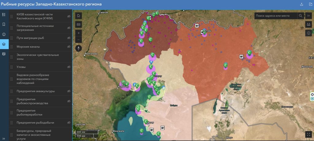
The GIS platform covers a wide range of data. Includes observation stations and information on the state of zoobenthos, zooplankton and phytoplankton. The Shannon-Weaver information index is used to assess biodiversity, dividing objects into categories: >2.5 bits/mg for zoobenthos and >15 bits/mg for zooplankton indicate high biodiversity, while values <0.1 and <0 bits/mg indicate a critical state of the ecosystem. Phytoplankton is also assessed using gradation: a value of >3.5 bits/mg indicates a healthy state of the reservoir, while a value of <1.56 bits/mg signals degradation.
Particular attention is paid to monitoring water pollution, bottom sediments and fish muscle tissue at various stations. Total pollution indicators vary from <3.5 mg/kg to >10 mg/kg in muscle tissue and from <50 mg/kg to >200 mg/kg for bottom sediments, which allows identifying potential sources of pollution. An important element is the use of the Water Body Pollution Index (WBI) for small reservoirs, rivers and the Kazakhstani part of the Caspian Sea. According to the WBI, the objects are divided into classes: normatively clean, moderately polluted and polluted.
The platform also includes data on the migration routes of semi-anadromous and sturgeon fish, which are important for preserving biodiversity, and describes ecologically sensitive zones and sea channels where special monitoring is required. Catches are recorded at stations with a classification by intensity: from <1 kg/net for 12 hours to >10 kg/net, which helps to assess the state of fish stocks and the efficiency of fishing.
An important component of the project is the analysis of aquaculture, reproduction, processing and fishing enterprises located in the region. The system allows tracking the number, capacity and distribution of these enterprises and assessing the overall fishery potential. Fish productivity of the sites is also assessed: sites with a value of >10 kg/ha demonstrate high potential, while values of <10 kg/ha require additional measures to restore productivity.
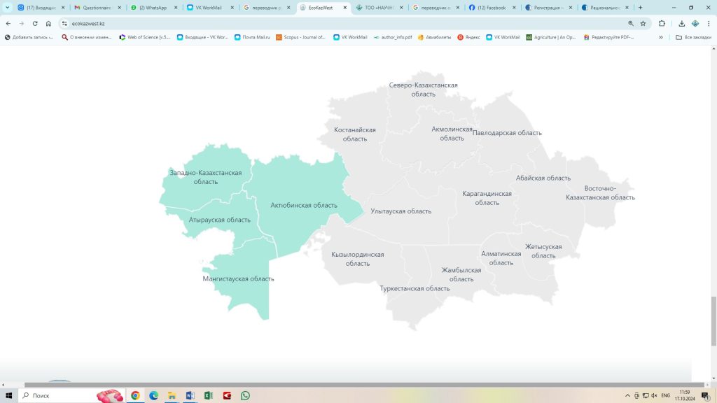
The GIS project covers key water bodies of the region, including the Caspian Sea, the Zhaiyk, Kigash and Kushum rivers, the Kirovskoye, Dongelek, Pyatimarskoye and Aktobe reservoirs, as well as the Shalkar, Baitakkol and Karmakkol lakes. This allows for a complete picture of the state of natural capital and ecosystem services in each of the regions of Western Kazakhstan: West Kazakhstan, Atyrau, Mangistau and Aktobe regions.
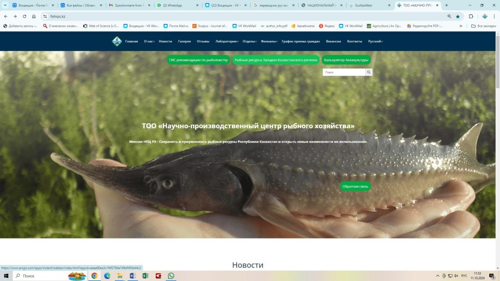
The web application is located on the official website of the program https://ecokazwest.kz/region/65d20963577d62f2b15fbdb1 and LLP “FishRPC” https://fishrpc.kz/, which allows users to get full access to data and analysis tools: https://www.arcgis.com/apps/instant/sidebar/index.html?appid=aeaa00ea3c1f4f2784a749df450e44c2